




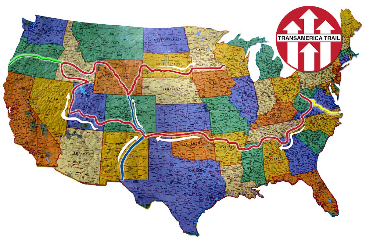
The TransAmerica Trail (TAT) is the most iconic self-guided adventure route in the United States. It is not an organization, but rather a carefully mapped route that allows you to cross the country from coast to coast (Atlantic to Pacific) almost exclusively on dirt roads, forest roads, and public trails.
The concept was entirely developed and mapped by Sam Correro, an American enthusiast who spent more than a decade connecting rural roads across the U.S. to create this continuous and awesome route.
1. ✨ The Spirit and Legacy of TAT
The TAT is a journey of profound isolation and discovery through rural America, far from the busy highways.
TAT wasn’t founded by an organization, but through the dedication of a single motorcyclist.
- The Founder: The TAT was conceived and mapped by dual-sport motorcycle enthusiast Sam Correro, who began exploring off-the-beaten-path trails in 1984 and spent about 12 years riding the original route.
- The Original Route: The original route, approximately 8,300 km long, connects Cape Hatteras in North Carolina (Atlantic) to Port Orford in Oregon (Pacific).
- Motivation: Sam Correro’s goal was to create a route where motorcyclists could travel across the U.S. legally and safely, avoiding highways and paved roads as much as possible, so they could experience the rural heart of America.
2. 🗺️ The Route and Its Stages
The TAT runs through the heart of America, passing through about ten states, with a marked change in the landscape as it heads west:
- Eastern Leg (Southern States): The route begins (or passes through) states such as Virginia, Tennessee, Mississippi, and Oklahoma. In this leg, the terrain consists mainly of rural roads and forest trails (often muddy or sandy), and the pace of travel is faster.
- Western Section (Mountains and Desert): Starting in New Mexico, the difficulty and elevation increase. The route passes through:
- Colorado: Famous for its high-altitude mountain passes. The window for crossing is short (late June through September) due to snow.
- Utah: Known for its desert landscapes and rocky trails, which really put motorcycles and riders to the test.
- Nevada and Oregon: The journey continues through national forests and remote landscapes until reaching the Pacific Ocean.
3. ⚠️ Planning and Logistics for the Crossing
The size of the TAT requires careful planning, especially with regard to navigation and maintenance:
- Directional Navigation: The original TAT guides and routes are optimized for east-to-west navigation, starting at the Atlantic and ending at the Pacific.
- Completion Time: The full TAT takes, on average, about 4 to 6 weeks of continuous riding, with the fastest riders completing it in 3 to 4 weeks (assuming about 320 km per day).
- Fuel Logistics: The route is divided into sections, with the end of each section typically coinciding with a gas station, requiring the motorcycles to have a minimum range of about 260 km.
- Best Time of Year: Due to snow conditions in Colorado and the possibility of extreme heat in the Utah desert, the ideal time for a complete crossing is summer (late June through early September).
The TransAmerica Trail is, in essence, the ultimate off-road pilgrimage for any adventurer who wants to symbolically connect the two oceans.
Have you hiked any part of the TAT yet? Send us your story

Related Posts
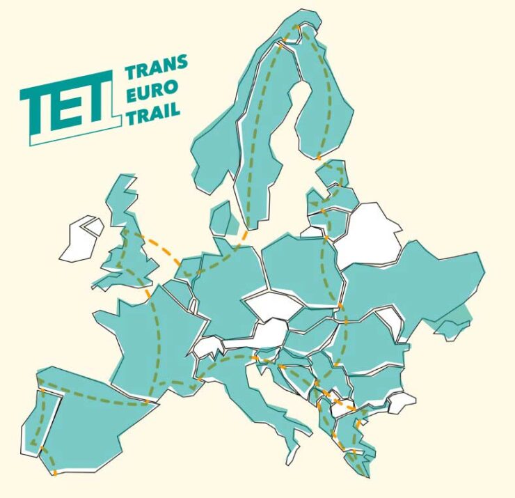
The Trans Euro Trail (TET) is a vast network of trails that stretches over 100,000 km and crosses more than 30 European countries, from the tip of Africa to the Arctic Circle. The TET is a colossal project, driven by the community and a passion for discovering Europe in a way that most tourists can’t even imagine.

Traveling by motorcycle through the United States is the dream of many motorcyclists. Endless roads, breathtaking landscapes and legendary routes such as the mythical Route 66 or the challenging Tail of the Dragon make this country a unique destination. But beware: driving rules and even the climate vary greatly from state to state, and you should be prepared.